


“Redband Artworks”の事務所は、
北海道・十勝地方の中核都市「帯広市」に位置しています。

 車でのアクセス
 レンタカー
レンタカー 高速バスでのアクセス
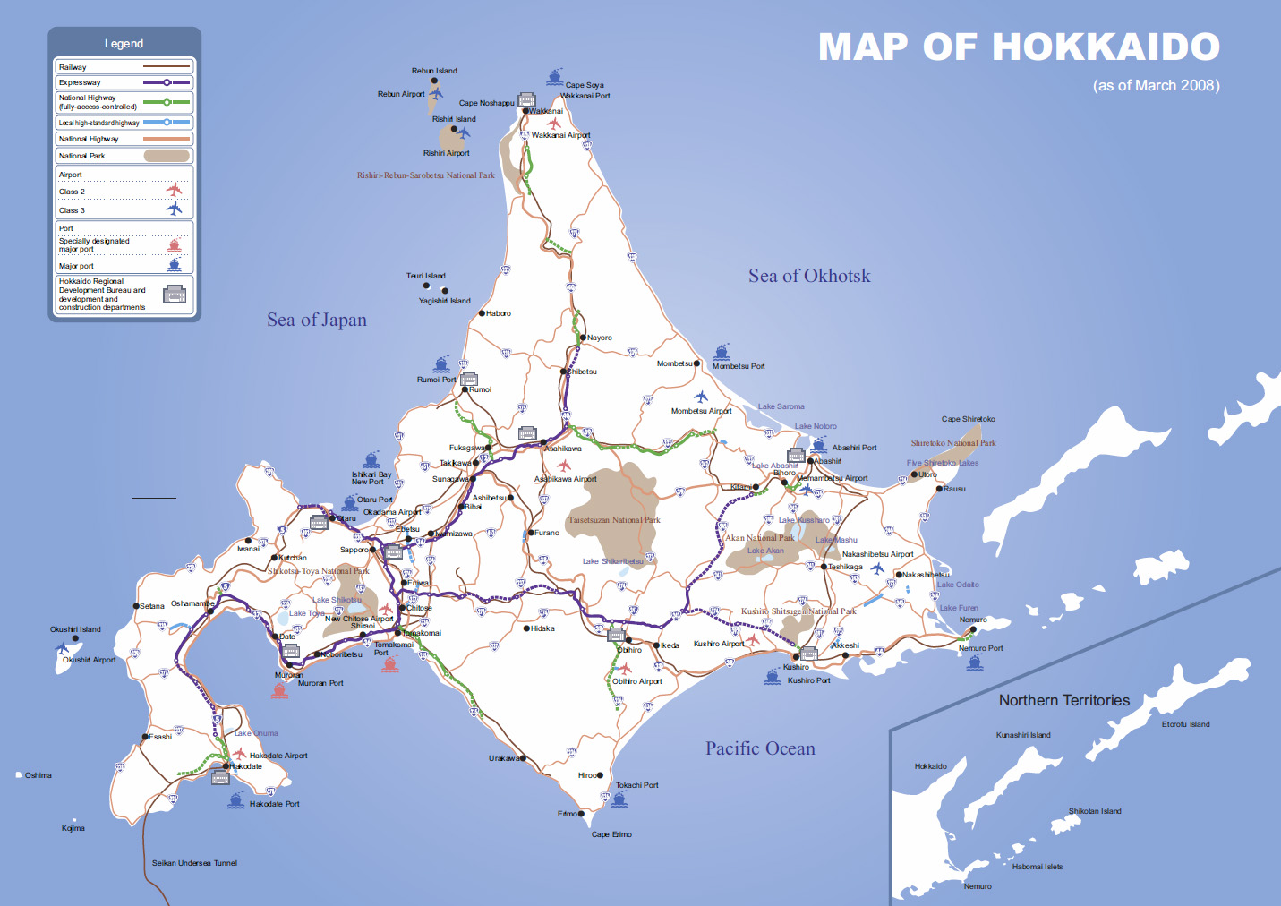
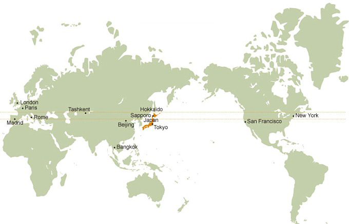
139°20’ – 148°53’ E. Long. 41°21’ – 45°33’ N. Lat.
Despite being at the northern tip of Japan, Hokkaido is located on similar latitudes to major American and European cities.
83,456 km2 (including 5,036 km2 of the Northern Territories) Accounting for 22% of the total area of Japan (October 2007), it is the largest prefecture and is equivalent to the size of Austria or twice that of the Netherlands or Switzerland.
Hokkaido’s annual mean temperature is around 10.0ºC, which is similar to that of Chicago or Boston in North America.
Hokkaido enjoys four distinct seasons with no rainy season and a cool, refreshing summer with low humidity. In winter, there is considerable snowfall on the Sea of Japan side and there are many days with freezing temperatures even in the daytime.
Surrounded in all four directions by the Pacific Ocean, the Sea of Japan and the Sea of Okhotsk, Hokkaido is home to a variety of magnificent mountains, extensive wetlands, beautiful lakes, marshes, rivers, forests and more. With expansive farmland, also referred to as the breadbasket of Japan, the prefecture produces a variety of products, consisting mainly of rice, dry-field crops, and dairy and livestock products.
Hokkaido has two volcanic zones, along which many volcanoes and hot springs exist.
※「十勝総合振興局産業振興部商工労働観光課」「国土交通省 北海道局」「帯広観光Navi」ホームページより転載
 飛行機でのアクセス
 列車でのアクセス